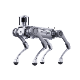
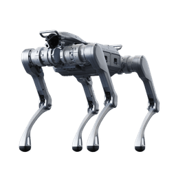
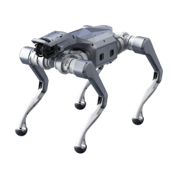
Why use a legged robot in tunnels and caves?
Wheeled and tracked vehicles are efficient on flat ground. Underground, the ground keeps changing: service stairs, cable trenches, collapse rubble, wet rock and narrow passages. A legged robot steps over most of these.
The strongest public example is the DARPA Subterranean Challenge (SubT). At the 2021 final, winner CERBERUS fielded ANYmal quadrupeds, and CSIRO Data61, tied on points and ranked second, used tracked robots plus Spot. Both teams ran legged platforms through tunnel, cave and urban underground sections.
Legs do not solve everything. Wading depth, behaviour in slippery mud and recovery after a fall are not published by manufacturers. These are measured on site.
How does the robot localize and build a map underground?
There is no GPS underground, so the robot works out its position from its own sensors. At the SubT final almost every team used LiDAR-based SLAM (simultaneous localization and mapping). The laser scanner measures the surroundings, the readings are fused with an inertial sensor, and the map is built as the robot walks.
- LiDAR is the primary sensor. In darkness, dust and irregular cross sections it gives the most reliable data.
- Thermal is for detection. It finds people, hot spots and fire traces. We found no work validating thermal-based navigation on quadrupeds.
- Map merging combines pieces from several robots into one map. CSIRO shared a map piece every 5 seconds. By the team's own analysis the mean error was about 3 cm, and DARPA scored their coverage at 91%.
For choosing a thermal payload, see the thermal camera robot dog guide.
Why is communication the real problem underground?
A tunnel behaves like a waveguide for radio. Signals below the cutoff frequency set by the cross section do not propagate. Measurements in metro-size tunnels put the most efficient band at roughly 400 MHz to 1 GHz. Too low and the signal does not travel down the tunnel; too high and it fades quickly at bends.
Natural caves are harder, with irregular cross sections and many turns. We found no published cave-specific measurement, so range is measured again at every site.
The robot's own Wi-Fi may be enough in the open. In a tunnel it can drop after a few bends, and the mission has to be planned around that.
How do relay nodes and store-and-forward work?
The SubT answer was relay nodes dropped behind the robot as it advances, often called breadcrumbs. Each node links to the previous one and extends the network into the tunnel.
- CERBERUS: each node weighed 245 g with about 2 hours of battery, and each carrier ANYmal could hold 4 nodes. The team also used a vehicle tethered to base with about 300 m of fiber.
- CSIRO: every robot had 4 node droppers. Maps and detections moved over a delay-tolerant transport layer, while video was sent best effort.
Store-and-forward means the robot keeps data while it has no link and sends it once it reconnects. In CSIRO's run, data from a Spot that had fallen over was carried out by another robot passing by.
To be clear: beyond the last relay, live video does not reach the base. Detections and map pieces arrive when the link is restored or another robot carries them out. For running several robots this way, see the robot dog fleet management guide.
How do you keep a link in a cave of unknown threat without leaving relays behind?
Dropping static relay nodes works in mines and competitions. In a cave where you do not know who is inside, a dropped node can be found, captured or reveal the team's route. The answer is a layered setup that leaves no electronics behind:
- Fiber paid out from the robot: the lead robot lays thin optical fiber from a spool on its back. With no radio emission it does not give away its position and cannot be jammed. Drone-class fiber weighs roughly 300 g per 3 km, so a 40 kg payload platform such as the Unitree B2 carries a 1-3 km spool easily. The fiber can be cut, and that is treated as a planned event.
- A mobile relay robot: instead of a static node, a Unitree A2 or As2 follows the lead robot, holds a bend when needed and withdraws when the task ends.
- Radio-silent autonomous exploration: if the link drops or emissions are not allowed, the robot moves on without transmitting, records map and video, then returns to the last good-link point to hand over the data.
- Through-the-earth emergency messaging: very low frequency systems used in cave rescue carry only short status and position, never video.
Data on the robot is encrypted and wiped remotely if the robot cannot be recovered. We build these layers on the mission computer with our own software, and the fiber spool and behaviours for a quadruped are field-tested on every project.
What does the robot do when the link drops?
An underground robot has to treat being offline as normal. SubT teams wrote explicit rules for it:
- CERBERUS used a "WiFi Safety" behaviour: after a set number of failed pings the robot backs off and searches for the link again.
- A return-home timer triggers when the time budget runs out.
- CSIRO robots turned back when the battery reached a critical level.
These behaviours rely on the robot's own SLAM map, since the way back is stored in it. When working without a link, we recommend keeping autonomy limited to sensing and mapping. Any decision that affects people stays with the operator.
Keeping data inside your network is an architecture decision, not a built-in property of the robot. We check it with independent traffic tests. A test only shows the traffic observed while it runs, so monitoring continues after deployment. Details are in the offline robot dog and data security guide.
How long does the battery really last underground?
Brochure endurance assumes flat ground and a light load. Underground, climbing, sensor payloads and cold air cut it down. In SubT, Spot ran for about 40-45 minutes and ANYmal for about 80 minutes. Those figures do not transfer directly to current Unitree models, but they show the gap between brochure and field.
- The mission plan should reserve separate battery for the way in and the way out.
- Hot-swappable batteries (A2) or quick battery change (B2) shorten downtime at the entry point.
- Relay nodes need charging too. CERBERUS nodes lasted about 2 hours.
- Joint motors heat up in long autonomous runs; CSIRO saw motor burnouts. Log joint temperatures from day one.
Which of B2, A2 and As2 fits which underground task?
The values below are manufacturer-stated. No independent field measurements have been published.
| Feature | Unitree B2 | Unitree A2 | Unitree As2 |
|---|---|---|---|
| Weight | about 60 kg | about 42 kg | about 20 kg |
| Payload while walking | over 40 kg | about 25 kg | 15 kg (X/EDU) |
| Step height | 20-25 cm continuous | 30 cm | 25 cm |
| Slope | over 45 degree claim (manual: under 20 degrees in normal mode) | 40-45 degrees | 40 degrees |
| Protection rating | IP67 | IP56 (IP56-IP67 on PRO) | IP54 (PRO/X/EDU) |
| Battery | 2250 Wh, quick swap | 2 hot-swappable packs, 453.6 Wh each | 648 Wh |
- Unitree B2: for wet tunnels, heavy sensor payloads and long missions. IP67 helps with water and dust. On slopes, read carefully: the product page claims over 45 degrees, while the user manual gives under 20 degrees in normal mode and under 45 degrees in AI mode low gear. For the wheeled B2-W, the manufacturer states 25 km of range with a 40 kg load, which makes it worth considering for long runs on flat tunnel floors.
- Unitree A2: a 30 cm step claim for high sills and rubble. The manufacturer's manual lists a 128-channel LiDAR with a 360 x 189 degree field of view and 40 m range.
- Unitree As2: for narrow passages, fast deployment from a vehicle and light reconnaissance. IP54 and a 15 kg payload limit heavy thermal heads and carrying many relays.
For a detailed head-to-head, see As2 vs B2.
Have Unitree robots been used in caves?
Short answer: we found no public, documented Unitree cave operation. Published underground evidence is limited to ANYmal, Spot and tracked robots, and no SubT team used Unitree.
That does not mean Unitree robots cannot work underground. It means gait, communication and endurance have to be measured and confirmed at each site, which is why we start projects with a pilot test.
At Robotlar.org we have already built many of the components in this guide in earlier projects: LiDAR mapping, thermal payloads, on-premise servers and closed networks. We integrate your underground mission from these building blocks to fit your project.
How does Robotlar.org run an underground pilot test?
The pilot runs at your real site against measurable criteria, and we set the pass thresholds together with you.
- Mapped length: the distance over which the robot produces a reliable map in a single mission.
- Checkpoint error: the difference between surveyed points on site and their position on the map.
- Relays per 100 m: shows the communication cost of your site directly.
- Return on link loss: whether the robot comes back on its own when the link drops.
- Battery per mission: remaining charge after a loaded mission and battery swap time.
- Terrain performance: falls on loaded stairs and interventions per km on rocky slopes. Slope tests run in both normal and AI mode.
Model choice, relay layout and payload are settled by the pilot results. To describe your site and goals, fill in the quote form. For related field scenarios, see the search and rescue and mining site guides.